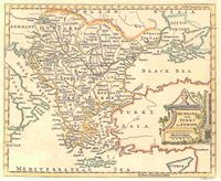
Maps
From Just Solve the File Format Problem
(Difference between revisions)
Dan Tobias (Talk | contribs) (Created page with "{{FormatInfo |formattype=Languages |subcat=Written Languages |image=Hungary with Turky in Europe.jpg |caption=Old map of Hungary and Turkey }} '''Maps''' are graphical repres...") |
Dan Tobias (Talk | contribs) (→Links) |
||
| Line 12: | Line 12: | ||
* [http://www.openstreetmap.org/ Open Street Map] | * [http://www.openstreetmap.org/ Open Street Map] | ||
* [http://www.buzzfeed.com/awesomer/maps-you-never-knew-you-needed 38 Maps You Never Knew You Needed] | * [http://www.buzzfeed.com/awesomer/maps-you-never-knew-you-needed 38 Maps You Never Knew You Needed] | ||
| + | * [http://www.bubblews.com/news/562608-10000-year-old-map-found-stuns-science-community 10,000 Year Old Map Found Stuns Science Community] | ||
Revision as of 00:37, 3 June 2013
Maps are graphical representations of geographical data. They have been produced for as long as humanity has been exploring the Earth, and now there are maps of astronomical bodies outside the Earth as well. Originally done on paper or parchment, maps are now also done electronically (as with just about every other medium), and there are now online maps such as Google Maps and Open Street Map which can be scrolled, zoomed, and otherwise manipulated.
